Right Playground › Nashville › Paul Johns Neighborhood Park aka: Rock Springs Park
Paul Johns Neighborhood Park aka: Rock Springs Park 4.5★ · 153 Google ratings · Smyrna, Tennessee
✓ Toddlers✓ Splash pad✓ Shade✓ Restrooms✓ Step-free
At a glance
What visitors report about Paul Johns Neighborhood Park aka: Rock Springs Park Age
Toddlers + young kids Based on visitor reports · 2016–2024
Shade
Shade reported Mentioned by 5 visitors · 2016–2024
Restrooms
Yes · often seasonal
Water play
Splash pad on site Based on visitor reports · 2016–2024
Crowds
Quietest Sun 8am · busiest Sun evening
Size
About 6,200 sq ft · bigger than 66% of the ones we measured
Shown only when the evidence clears our bar. How we know this .
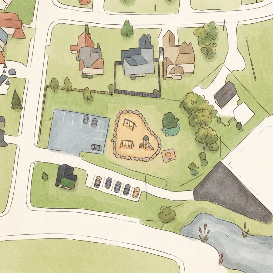
The site plan
Map of Paul Johns Neighborhood Park aka: Rock Springs Park 1
2
3
4
1 Play area2 Restroomsabout 200 ft from the play area 3 Parkingabout 100 ft from the play area 4 Covered shelterabout 50 ft from the play area
Drawn from aerial imagery, showing the real layout. Guide
Good to know Good for a picnic
Picnic facilities on site, with room to sit and eat near the play area.
Official listing
Good for hot days
Splash pad on site, with some reported shade.
Based on visitor reports · 2016–2024
Works well for younger kids
Visitors report equipment suited to under-5s.
Based on visitor reports · 2016–2024
Equipment wear reported
Some visitors report worn or dated equipment.
Based on visitor reports · 2016–2024
Bring water on hot days
There's a splash pad and mister that run in summer, but reviewers noted no water fountains available.
Go on weekday afternoons
The park gets crowded after 3pm on weekends but stays quiet during the week.
Plan for windy conditions
This park experiences noticeably more wind than other local parks, so account for wind chill in cold weather.
Supervise near the creek
A drainage creek runs nearby the park, so watch young children closely around the walking trail.
Distilled from 61 visitor reviews.
Crowds
When it gets busy Weekday mornings are generally quiet; weekend afternoons get busiest.
Quiet Busy
From Google visit patterns, 8am to 7pm.
Practical
Plan your visit 📍 2900 Iona Dr, Smyrna, TN 37167
🚻 Bathrooms about 150 ft from the play area
Questions
Parent FAQs Does Paul Johns Neighborhood Park aka: Rock Springs Park have restrooms? Yes. Public restrooms are on the official Google listing. Park restrooms are often seasonal, so check before a winter visit.
Is there shade at Paul Johns Neighborhood Park aka: Rock Springs Park? Visitors specifically mention shade: trees, sails or covered seating.
Does Paul Johns Neighborhood Park aka: Rock Springs Park have a splash pad? Yes. Visitors describe built water play on site. Splash pads in the Nashville area typically run late May to early September.
Is Paul Johns Neighborhood Park aka: Rock Springs Park good for toddlers? Yes. Visitors mention equipment suited to under-5s. Based on visitor reports · 2016–2024
When is Paul Johns Neighborhood Park aka: Rock Springs Park least busy? Based on Google visit patterns, the quietest daytime hour is Sunday around 8am.
More in Nashville
Other lists this one is on Contribute
Been here recently? Help other parents with fresh information about Paul Johns Neighborhood Park aka: Rock Springs Park. Everything below is optional except the last box.
Contributions are reviewed before appearing on Right Playground. We never publish your email address.
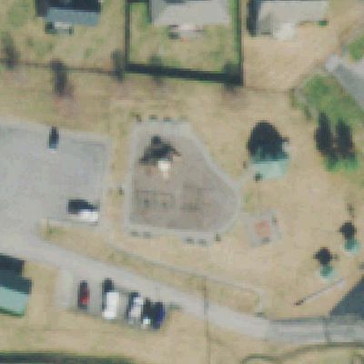
How we know this. Place details from the public Google business listing; facilities inferred from 61 visitor reviews; playground outlines and amenity positions from OpenStreetMap (ODbL), which is also what the size is measured on; aerial imagery from USGS (2021). Attributes appear only when the evidence clears our confidence bar, and review text is never republished. The unedited aerial shows tree cover, which is our second check on shade. Read the method · Report a mistake